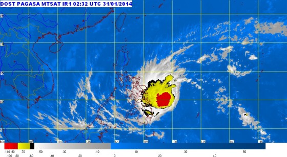
Typhoon Basyang Satellite image
Credit: PAGASA
Typhoon Basyang has intensified into a tropical storm according to the latest weather forecast issued by the Philippine Atmospheric, Geophysical and Astronomical Services Administration (PAGASA) at 11 a.m. on Friday, January 31, 2014. Signal number 2 is now up in several areas. (See the list of areas under public storm warning signal below.)

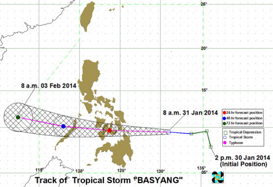
Typhoon Basyang Track
Credit: PAGASA
The fourth weather update by PAGASA on Typhoon Basyang indicated that the tropical storm is currently moving towards Leyte and Caraga area.
As of 10 a.m. today, PAGASA spotted Typhoon Basyang at 500 km East Northeast of Hinatuan, Surigao del Sur. Typhoon Basyang is moving in the western direction at 30 kph with maximum sustained winds of 65 kph near the center and gustiness of up to 80 kph.
According to PAGASA weather forecast, Typhoon Basyang will be in the vicinity of Naga City, Cebu by Saturday morning and about 133 km Northwest of Puerto Princesa City on Sunday. Basyang will be about 729 km West Northwest of Puerto Princesa City or outside the PAR by Monday morning.
Public Storm Warning Signal was raised by PAGASA in the following areas.
|
||||||||||||||||||
PAGASA is alerting residents living in low lying and mountainous areas under public storm warning signal #2 and #1 of possible flashfloods and landslides. There is also a possibility of storm surges in areas under public storm signal #2.
Fishing boats and other small seacrafts are being discouraged to sail into the eastern seaboards of Central and Southern Luzon due to the surge of Northeast Monsoon.
The next PAGASA weather bulletin will be posted on this site at 5 p.m. today.
